
Written by Ceezaer Drone Services
Official publication of ceezaer.com — Veteran-Owned · FAA Part 107 · Round Rock, TX
Official publication of ceezaer.com — Veteran-Owned · FAA Part 107 · Round Rock, TX
Texas maintains more than 55,000 bridges, more than any other state, and federal rules require most to be inspected at least every 24 months. Bridge inspection drones are changing how those inspections get done, replacing snooper trucks and rope crews with high-resolution imaging and AI-assisted defect detection. Here is how the shift is unfolding and what it means for Central Texas agencies and contractors.
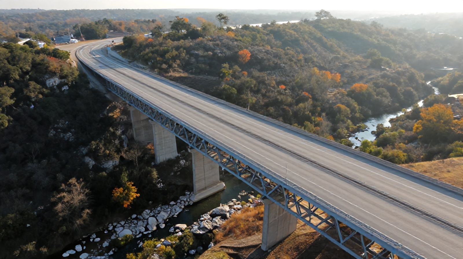
The traditional bridge inspection relies on under-bridge inspection trucks, bucket lifts, and rope-access technicians. Bridge inspection drones are steadily supplementing that toolkit because they reach hard-to-access spans faster and keep people off the structure.
Under the National Bridge Inspection Standards (NBIS), most highway bridges must receive a routine inspection at least once every 24 months, with fracture-critical and complex structures inspected more often. Texas alone carries responsibility for more than 55,000 bridges, so the sheer volume of recurring work creates constant pressure to inspect faster without lowering data quality.
An under-bridge inspection truck, often called a snooper, can cost $1,500 to $3,000 per day to mobilize, frequently requires lane closures, and needs traffic control that can run into the thousands more. Drones flip that equation. A pilot can capture the underside of a girder, a bearing, or a pier cap from the ground or an adjacent right-of-way, often without closing a single lane. The result is fewer traffic disruptions, lower mobilization costs, and dramatically less exposure for inspection crews working over water or traffic.
None of this eliminates the certified bridge inspector. Federal rules still require a qualified team leader to evaluate the structure and sign the report. What changes is the data collection method: instead of physically touching every element, the inspector reviews centimeter-level imagery and thermal data gathered by the aircraft.
A modern bridge inspection drone flight is a structured process, not a casual flyover. Each stage is designed to produce documentation that holds up in an engineering review.
The team reviews existing plans, prior inspection reports, and the element list. Flight paths are planned around the deck, girders, bearings, piers, and abutments. Airspace is checked for proximity to airports, and a Part 107 waiver is filed if the structure sits in controlled airspace or requires operation over traffic.
The drone flies methodical passes, capturing overlapping high-resolution photos and, when moisture or delamination is suspected, thermal imagery. Confined underdeck areas may use obstacle-avoidance drones or caged aircraft that can operate close to steel and concrete without GPS.
Images are stitched into 3D models and orthomosaics. AI-assisted software flags cracks, spalling, corrosion, and section loss, measuring crack widths down to fractions of a millimeter and comparing findings against the previous inspection cycle.
A certified inspector reviews the flagged findings, assigns NBIS condition ratings, and produces the documented report. Georeferenced imagery lets the agency zoom to any defect and track its progression over time.
The benefits go beyond simply avoiding a bucket truck. Drones change the economics, safety profile, and data quality of the entire inspection program.
Inspecting a bridge over the Colorado River or a busy interstate no longer requires technicians to rappel over water or work from a platform above moving traffic. Keeping people on the ground is the single biggest safety gain.
Many drone inspections avoid lane closures entirely. That removes traffic-control costs and eliminates the congestion and rear-end collision risk that closures create around Austin-area corridors.
Field time on a typical structure drops by roughly 40 percent compared with manual access. That lets agencies clear more bridges per inspection season with the same personnel.
Every flight produces a permanent, georeferenced visual record. Two years later, the next inspector can compare identical viewpoints to measure exactly how a crack or corrosion patch has advanced.
Caged and obstacle-tolerant drones reach box girder interiors, bearing seats, and confined pier areas that are dangerous or impossible to inspect by hand.
Eliminating snooper mobilization, reducing traffic control, and shrinking field hours can lower the cost of routine access work substantially on suitable structures.
Bridge inspection drones are a powerful tool, not a complete replacement for hands-on evaluation. Understanding the limits keeps expectations realistic and the inspection defensible.
Visual and thermal imaging cannot always replace physical testing. Sounding concrete with a hammer to detect delamination, taking coating thickness measurements, or performing detailed fatigue-crack testing on fracture-critical steel still requires hands-on access. Federal guidance treats drones as a supplement to, not a substitute for, the judgment of a qualified inspector.
Environmental conditions matter. Sustained winds above roughly 20 to 25 mph, rain, and poor lighting under a deck can limit flight quality. GPS is often unreliable directly beneath a bridge, so crews need aircraft that hold position visually or through onboard sensors. Operations over traffic or people require specific FAA Part 107 waivers, and flying near Austin-Bergstrom or regional airports adds airspace coordination.
There is also a data management reality. A single large structure can generate thousands of images and multi-gigabyte 3D models. Agencies need a workflow and platform to store, review, and compare that data across cycles, or the imagery becomes a liability instead of an asset. This is where AI-assisted analysis and structured reporting earn their keep, turning raw captures into ranked, measurable findings an inspector can act on quickly.
Between the I-35 corridor, the many spans crossing the Colorado River and area lakes, and rapid suburban growth in Williamson and Travis counties, Central Texas has an unusually dense and aging inventory of bridges to keep inspected.
For engineering firms, municipalities, and contractors supporting TxDOT-style programs, drones offer a way to keep pace with mandated 24-month cycles while controlling cost and reducing risk to crews. A drone inspection can document a rural farm-to-market overpass in a fraction of the time a snooper truck would need, and it can revisit the same structure every cycle to build a longitudinal record of deterioration.
As a veteran-owned, FAA Part 107 certified operator based in Round Rock with $1.5 million in liability coverage, Ceezaer supports infrastructure clients with the specialized flight planning, waiver management, and AI-powered reporting these projects demand, delivering documented findings within a 48-hour turnaround on most structures. The certified inspector still owns the engineering judgment; the drone and the analytics platform simply give that inspector far better data to work from.
© 2026 Ceezaer™ Drone Services. This article was written and published by Ceezaer (ceezaer.com). All rights reserved — reproduction or republication without written permission is prohibited. Original URL: https://ceezaer.com/blog/bridge-inspection-drones-txdot-changing
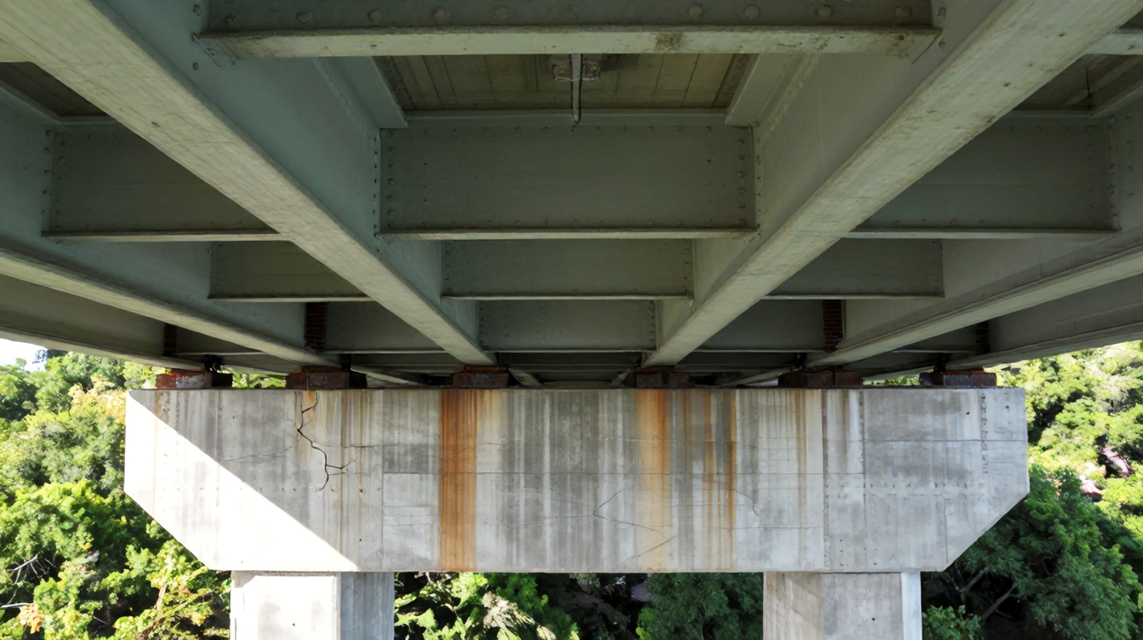
A deeper walkthrough of the full drone bridge inspection process and equipment.
Explains the imaging and 3D modeling methods behind structural inspections.
Another vertical infrastructure inspection case where drones replace risky climbs.