
Written by Ceezaer Drone Services
Official publication of ceezaer.com — Veteran-Owned · FAA Part 107 · Round Rock, TX
Official publication of ceezaer.com — Veteran-Owned · FAA Part 107 · Round Rock, TX
Photogrammetry and LiDAR both produce accurate 3D site data, but they solve different problems and carry very different price tags. Photogrammetry equipment costs a fraction of LiDAR, while LiDAR sees through vegetation photogrammetry cannot. This guide breaks down the real tradeoffs so you pick the right tool the first time.
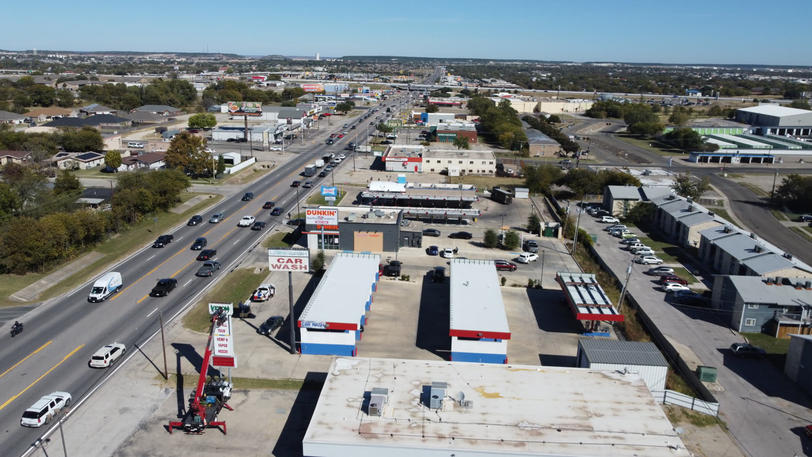
Both methods build survey-grade 3D models from the air, but they capture data in fundamentally different ways.
When clients ask us to map a site, the first conversation is almost always drone photogrammetry vs LiDAR. The confusion is understandable because both deliver point clouds, digital surface models, and volumetric measurements. The difference is how they see the world.
Photogrammetry is a passive imaging technique. A drone flies a grid pattern and captures hundreds or thousands of overlapping high-resolution photos. Software then matches common points across those images and triangulates their positions in 3D space, reconstructing the surface from color pixels. It is essentially the same principle your eyes use to perceive depth, scaled up with computing power.
LiDAR, short for Light Detection and Ranging, is an active sensor. It fires up to hundreds of thousands of laser pulses per second and measures the time each pulse takes to return. Because it emits its own energy, LiDAR does not depend on ambient light or surface texture. Critically, individual laser pulses can slip through gaps in vegetation and record multiple returns, capturing both the treetops and the bare ground beneath in a single pass.
That single distinction drives most of the decision. If you can see the surface you need to measure, photogrammetry usually wins on cost and detail. If the surface is hidden under grass, brush, or tree canopy, LiDAR is often the only way to get accurate ground elevations.
Accuracy claims get thrown around loosely. Here is what each technology realistically delivers.
Well-executed drone photogrammetry with ground control points routinely achieves 1 to 3 centimeters of horizontal accuracy and roughly 2 to 5 centimeters vertically. Those numbers depend heavily on flight altitude, image overlap, camera quality, and the number and placement of ground control targets. Skip the ground control or use only onboard GPS, and vertical error can balloon to 10 centimeters or more.
Survey-grade LiDAR payloads paired with an inertial measurement unit and RTK or PPK positioning deliver comparable or slightly better vertical accuracy, often in the 2 to 5 centimeter range, and hold that accuracy more consistently across varied terrain. LiDAR's real advantage is not raw precision on an open surface but reliability on complex ones.
Two factors matter most when comparing accuracy in practice:
The takeaway: on an exposed construction pad or a quarry face, photogrammetry gives you everything LiDAR would, at lower cost, with better visual context. Introduce dense ground cover and LiDAR pulls ahead decisively.
Budget is usually the deciding factor once accuracy needs are understood.
The hardware gap is significant. A capable photogrammetry drone with a quality RGB camera runs a few thousand dollars. A survey-grade drone LiDAR payload with a stabilized inertial navigation system commonly costs ten times more, and heavier LiDAR sensors require larger, more expensive aircraft to carry them. That capital difference flows directly into service pricing.
For a typical Central Texas site, expect the following patterns:
Both methods fly quickly, but LiDAR often covers ground faster per flight because it is less sensitive to overlap requirements and lighting. Photogrammetry may need more passes to hit high overlap ratios.
Photogrammetry processing is computationally heavy. Reconstructing thousands of images into a dense point cloud can take hours to days on capable hardware. LiDAR point clouds are ready faster because the geometry is measured directly rather than reconstructed.
Photogrammetry projects generally cost less overall for open sites. LiDAR carries a premium justified only when vegetation penetration, night flights, or complex geometry demand it.
Both generate large datasets. High-resolution photo sets and dense point clouds can each run into tens of gigabytes per site, so plan for data management on recurring projects.
At Ceezaer we deliver processed photogrammetry outputs within our standard 48-hour turnaround for most sites, with LiDAR timelines quoted per project because sensor and terrain complexity vary. For the majority of construction, real estate, and roofing work in the Austin metro, photogrammetry is the more economical fit and hits the accuracy clients actually need.
The right choice depends on your terrain, deliverable, and tolerance for cost.
Construction earthwork, stockpile volume calculations, quarries, landfills, rooftops, and progress documentation on active sites. Anywhere the surface is exposed, photogrammetry gives you accurate measurements plus photorealistic context that helps stakeholders understand what they are looking at.
Wooded parcels, brush-covered right-of-way corridors, floodplain and drainage studies, and any project needing bare-earth elevations under canopy. LiDAR's multiple returns strip away vegetation to reveal true ground, which photogrammetry simply cannot do.
Power lines, cables, fences, and railings are hard for photogrammetry to reconstruct because they lack the surface area to match across images. LiDAR captures these thin objects reliably, which is why it dominates utility and transmission corridor work.
Many drone LiDAR payloads carry a camera, letting you fuse a colorized LiDAR point cloud with photogrammetric texture. For high-value projects with mixed terrain, combining both gives the geometric reliability of LiDAR and the visual richness of photogrammetry.
For most commercial clients we serve, the decision resolves quickly once we understand the terrain. A contractor tracking cut-and-fill on a graded pad needs photogrammetry. An engineer designing drainage across a brushy 40-acre tract needs LiDAR. When it is genuinely ambiguous, a short site assessment settles it.
Both methods feed the same downstream tools, so your existing workflow rarely needs to change.
Regardless of capture method, the outputs land in familiar formats. You can expect dense point clouds, digital surface and terrain models, contour lines, orthomosaic imagery, and volumetric reports. These integrate directly into CAD, GIS, and BIM platforms your team already uses.
Photogrammetry uniquely produces a true orthomosaic, a stitched, geometrically corrected aerial image you can measure directly. That single deliverable is why photogrammetry remains the default for progress mapping, site planning, and marketing visuals. LiDAR shines when the analysis depends on clean ground models, cross-sections, and precise elevation data across difficult terrain.
Whichever path fits, the value comes from turning raw captures into decisions. AI-assisted analysis can flag volume changes between flights, detect deviations from design surfaces, and quantify progress without manual measurement, compressing what used to take days of desk work into a reviewed report.
© 2026 Ceezaer™ Drone Services. This article was written and published by Ceezaer (ceezaer.com). All rights reserved — reproduction or republication without written permission is prohibited. Original URL: https://ceezaer.com/blog/drone-photogrammetry-vs-lidar-mapping-comparison
A closer look at the photogrammetry deliverable that drives site planning and progress tracking.
How aerial mapping turns point clouds into accurate cut-and-fill volumes.
Where photogrammetry and LiDAR point clouds feed into full site digital twins.