Written by Ceezaer Drone Services
Official publication of ceezaer.com — Veteran-Owned · FAA Part 107 · Round Rock, TX
Official publication of ceezaer.com — Veteran-Owned · FAA Part 107 · Round Rock, TX
Real estate drone photography pricing in Austin typically runs $150 to $600 per shoot in 2026, but the spread depends on property size, deliverables, and whether video is included. This guide breaks down real package rates, the factors that move the number, and how to tell a licensed operator from a bargain that costs you later.
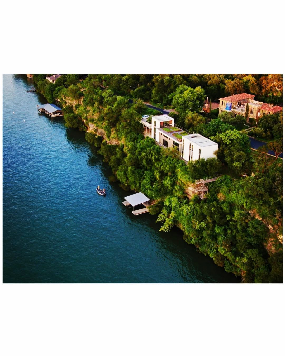
Aerial imagery has shifted from a luxury add-on to a baseline expectation on mid-to-high-end Central Texas listings. Here is what the numbers actually look like heading into 2026.
Across the Austin metro, real estate drone photography pricing in 2026 generally falls between $150 and $600 per shoot. A simple package of eight to twelve edited aerial stills on a standard suburban lot sits near the low end. Add cinematic video, twilight scheduling, a large acreage property, or a rush turnaround and you move toward the top of the range or beyond.
Those figures reflect a professional, FAA Part 107 licensed operator carrying liability insurance, not a hobbyist with a consumer drone. The gap matters. An unlicensed flight over a listing is a commercial operation in the eyes of the FAA, and the agent or brokerage that commissioned it can share exposure if something goes wrong. We will cover that distinction in detail further down.
It also helps to understand why Austin sits where it does on price. The metro has dense controlled airspace around Austin-Bergstrom, several smaller fields, and a steady volume of new-construction and luxury inventory. That combination keeps qualified operators busy and keeps rates slightly above the national small-market average but below coastal cities like Los Angeles or Miami.
Most Austin providers organize work into three or four tiers. Knowing what is bundled at each level prevents paying for a $450 package when a $200 one would have listed the home just as well.
Eight to fifteen edited high-resolution photos covering the roofline, lot boundaries, elevation, and neighborhood context. Ideal for standard single-family homes under a quarter acre where the goal is simply showing the property in its setting. Delivery is usually digital within one to three business days.
The stills package plus a 30 to 60 second edited aerial clip with music and simple motion. This is the most popular tier for listings in the $500K to $1M band, where a short reveal of the house and surrounding greenbelt measurably improves engagement on portals and social feeds.
Longer, choreographed flight paths, multiple orbits, twilight or golden-hour scheduling, and often a combined ground-and-air edit. Reserved for luxury homes, acreage estates, and ranch properties where production value directly supports the asking price.
Twilight shoots add $75–$150, rush 24-hour turnaround adds $50–$100, and property-line or lot overlays for land listings add $50–$125. Drone mapping or an aerial site plan for larger acreage is priced separately.
One note on bundling: many full-service photographers in the Austin area offer aerial as an add-on to a ground photo package rather than a standalone product. If you already book ground interiors, adding drone work to the same appointment is usually cheaper than two separate site visits, since travel and setup are shared.
Two listings a mile apart can be quoted $180 and $520. These are the variables that explain the difference.
A quarter-acre suburban lot shoots in twenty minutes. A ten-acre Hill Country property with outbuildings, pasture, and a tree-lined drive needs more flight time, more images, and often multiple battery sets. Acreage is the single biggest driver of a higher quote.
Video roughly doubles the on-site time and triples the editing hours. A still image is captured and lightly color-corrected. A cinematic clip requires planned flight paths, multiple takes, music licensing, and a timeline edit.
Much of the Austin metro sits in controlled airspace. Flights near Austin-Bergstrom, Georgetown, or San Marcos airports may require LAANC authorization or, in restricted zones, a manual waiver. That adds planning time and occasionally limits altitude, which can affect the shots available.
Standard delivery is one to three business days. A same-day or next-morning rush for a listing going live over a weekend commands a premium because it reshuffles the operator's edit queue.
Midday light is fine for most homes. Twilight and golden-hour shoots deliver the dramatic sky and warm window glow that sell luxury listings, but they require precise scheduling and often a second site visit if the earlier daytime shoot was separate.
A licensed, insured professional prices in the cost of FAA compliance, equipment, and a liability policy. A hobbyist undercuts on all three. The savings disappear fast if an uninsured flight damages property or draws an FAA enforcement action.
The cheapest quote is often an unlicensed one. For agents and brokerages, that is a liability question, not just a quality question.
Any drone flight conducted to market a property for sale is a commercial operation. Federal rules require the remote pilot to hold an FAA Part 107 certificate. Flying commercially without it is a violation, and the FAA can assess civil penalties. In practice, enforcement often reaches the party who hired and directed the flight, which means a brokerage can be drawn into a problem it did not create the images for.
Insurance is the second gap. A professional operator carries liability coverage specifically for aerial work. Ceezaer, for example, carries $1.5 million in liability insurance on every commercial flight. If a hobbyist's drone strikes a neighbor's vehicle or a window during your shoot, an uninsured pilot leaves the property owner and the agent exposed to the claim.
There is also a straightforward quality difference. Licensed operators understand airspace authorization, exposure for high-contrast Texas skies, and the composition conventions buyers expect. The result is usable imagery on the first visit rather than a reshoot that erases any savings. Before booking, ask for the pilot's Part 107 certificate number and a certificate of insurance. A legitimate operator provides both without hesitation.
For most Austin listings above the metro median price, the math favors adding drone imagery. The question is matching the tier to the property.
Industry survey data consistently shows that listings with aerial photos attract more online views and that a majority of buyers say aerial imagery influences whether they click into a listing at all. On a home where the lot, the greenbelt backdrop, or the proximity to amenities is a genuine selling point, aerial stills do work that ground photos cannot. The incremental cost of a $200 photo package against a six- or seven-figure sale price is minor, and the listing presentation benefit is immediate.
Where to be disciplined is on tier selection. A modest interior-lot home in a dense subdivision rarely needs a $600 cinematic package, because there is little surrounding context worth a choreographed flight. Those dollars are better spent on strong ground photography. Conversely, an acreage listing, a lakefront property, or a new build with a view corridor justifies video and twilight work because the aerial perspective is central to the value story.
Round Rock-based Ceezaer works across the Austin metro and typically delivers edited real estate imagery within 48 hours, which keeps a listing from stalling while photos are prepared. Whatever operator you choose, align the package to how much of the property's appeal actually lives above the roofline.
© 2026 Ceezaer™ Drone Services. This article was written and published by Ceezaer (ceezaer.com). All rights reserved — reproduction or republication without written permission is prohibited. Original URL: https://ceezaer.com/blog/real-estate-drone-photography-pricing-austin-2026
A deeper look at the service these prices pay for, from booking to delivery.
How sellers can get the most listing value out of their aerial imagery budget.
The data behind why aerial imagery earns its cost on the right listings.