Written by Ceezaer Drone Services
Official publication of ceezaer.com — Veteran-Owned · FAA Part 107 · Round Rock, TX
Official publication of ceezaer.com — Veteran-Owned · FAA Part 107 · Round Rock, TX
Aerial listing photos have gone from luxury add-on to buyer expectation across the Austin metro, where median home prices still hover well above the national average. For sellers, a single overhead shot can show lot size, pool placement, and neighborhood context that no ground photo captures. This guide covers what those photos cost, the FAA rules your photographer must follow, and how to make sure the investment actually moves your listing.
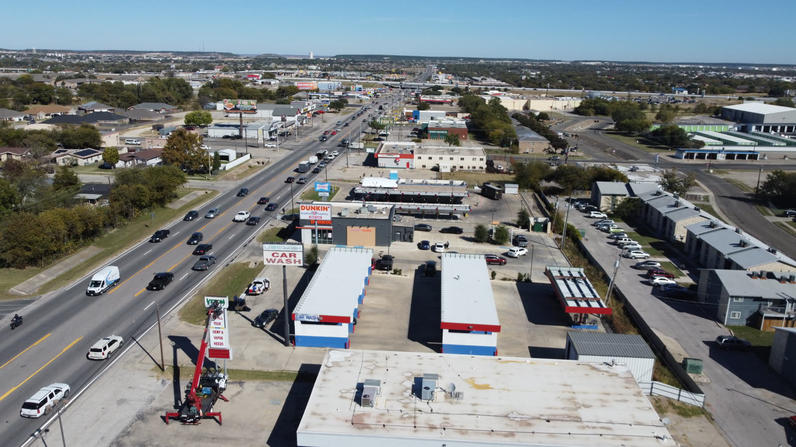
In a metro where lot size, proximity to greenbelts, and neighborhood layout drive pricing, aerial listing photos answer questions buyers ask before they ever schedule a showing.
Austin buyers are relocating from across the country, and many form their first impression online. A ground-level photo cannot show that your home backs to a wooded lot, sits three doors from a community pool, or has a half-acre yard behind the fence line. An aerial listing photo delivers all of that context in one frame.
The data is consistent nationally: the National Association of Realtors has reported that listings using aerial imagery tend to attract more online attention, and many local agents in Round Rock, Cedar Park, and Pflugerville now treat drone shots as standard for homes over roughly $400,000. For lots larger than a quarter acre, acreage properties in the Hill Country, or homes near lakes and preserves, aerial coverage is close to mandatory.
It is worth being realistic, too. Aerial photos will not fix a poorly maintained yard, a cramped floor plan, or an overpriced listing. They amplify genuine strengths. A tidy roof, mature trees, and a well-defined lot photograph beautifully from above; clutter and deferred maintenance become more obvious, not less.
Pricing varies with property size, package scope, and turnaround, but most residential sellers fall into a predictable range.
Roughly $150 to $250 for 5 to 10 edited overhead and angled stills, usually bundled onto a standard interior photo shoot. This is the most common choice for suburban homes on standard lots.
Around $300 to $500 for stills plus a 30 to 60 second aerial video clip suitable for social media and virtual tours. Popular for homes above $600,000 or properties with strong exterior appeal.
$500 and up for larger tracts requiring multiple flight paths, boundary context, and extended editing. Hill Country and lakefront listings often land here.
A $75 to $150 premium for dusk imagery, where warm interior lighting and sky color create the highest-engagement single image most listings will use.
Turnaround is a real cost factor. A professional service should return edited files within about 48 hours, which matters when you are trying to hit a Thursday listing launch. Ask any provider for their standard delivery window in writing before booking.
Any drone flown to produce photos you will use to sell property is a commercial operation, and that carries specific federal requirements.
This is the single most overlooked issue for sellers. Marketing photos are commercial use, so the pilot must hold an FAA Part 107 Remote Pilot Certificate. A neighbor with a hobby drone legally cannot shoot your listing photos, even for free, because hobby rules prohibit any flight tied to a business purpose. Using non-compliant imagery can expose you and your agent to liability.
When you interview a provider, confirm certification, insurance, and airspace authorization up front. A legitimate operator answers these questions in seconds. If a photographer hesitates, that is your signal to keep looking.
The difference between a compelling aerial shot and a forgettable one comes down to preparation and timing more than equipment.
Overhead cameras show everything. Mow and edge, remove trash bins and hoses, clear the driveway of vehicles, and hide pool cleaners. A morning of yard work has an outsized effect on aerial results.
Mid-morning or late afternoon produces even lighting and softer shadows. Harsh midday sun flattens texture and blows out light-colored roofs and concrete common in Central Texas.
Ask for a straight-down lot shot, a low oblique showing the home with neighborhood context, and one image highlighting the nearest amenity, such as a greenbelt, park, or lake.
Wind and rain ground drones. Central Texas spring storms and summer heat haze can both affect quality, so build a day of scheduling flexibility into your listing timeline.
Verify you receive full-resolution files licensed for MLS, social media, and print. Clarify who owns the images and whether the flight logs and shots stay available if you relist.
One caution: resist the urge to over-process. Skies that are too saturated or grass that is unnaturally green read as manipulation to experienced buyers and can trigger complaints under truth-in-advertising standards. Accurate, clean imagery builds trust.
Most delays come from booking too late, not from the shoot itself.
A typical residential aerial session takes 20 to 40 minutes on site. The larger variable is scheduling: professional operators in the Austin market often book several days out, especially in the spring and summer selling seasons. Plan to book at least a week before your target listing date.
If your home is near controlled airspace, add a small buffer for airspace authorization, though most LAANC approvals are near-instant. Editing and delivery then run about 48 hours with a professional service. Working backward from a Thursday launch, that means the shoot should happen no later than Tuesday, with booking confirmed the prior week.
For sellers coordinating interior photography, video, and floor plans, ask whether a single vendor can handle everything in one appointment. Bundling reduces cost, keeps lighting and style consistent across all your marketing, and avoids scheduling multiple crews around your move.
© 2026 Ceezaer™ Drone Services. This article was written and published by Ceezaer (ceezaer.com). All rights reserved — reproduction or republication without written permission is prohibited. Original URL: https://ceezaer.com/blog/austin-home-sellers-aerial-listing-photos-guide
The data behind why drone imagery shortens days on market.
A local look at drone listing photography across the Austin metro.
What separates listing-ready aerial cameras from hobby drones.