Drone photogrammetry has changed the economics of earthwork volume measurement. What once took a survey crew three days and $3,000 now takes 45 minutes and a fraction of the cost — with accuracy that satisfies TxDOT, civil engineers, and construction lenders. Here is the complete picture.
Understanding the limitations of traditional earthwork survey methods is the starting point for appreciating why drone photogrammetry has become the standard on Texas civil construction projects.
A licensed surveyor and instrument operator use a total station to collect point measurements across a cut or fill area, typically on a 25- to 50-foot grid. For a 10-acre earthwork site, this generates 400–1,700 measured points. The process takes 1–3 days depending on site complexity, access, and crew size. Total cost: $2,500–$8,000 per visit for mobilization, field time, and processing. Data points are sparse — the volume calculation interpolates surface conditions between measured points, introducing error at terrain inflections and slope changes that the grid spacing misses.
A drone flight over the same 10-acre site at 100 meters altitude takes approximately 25 minutes and collects 600–1,200 overlapping images. Processing generates a dense point cloud of 50–200 million points over the survey area — orders of magnitude denser than total station coverage. Volume is calculated from a digital surface model (DSM) derived from this point cloud, with uncertainty driven by the model's spatial resolution rather than by grid interpolation error. Total cost: $600–$1,500 per visit. Results within 2–4 hours of flight completion.
The drone approach is not just faster and lower-cost — the dramatically denser data produces more accurate volume calculations at terrain inflections (slopes, channels, stockpile peaks) than total station grid surveys can achieve at practical grid spacings. This is particularly significant on Texas Hill Country projects where terrain complexity is high and standard grid surveys systematically under-sample slope transitions.
Each step in the workflow has quality implications for the final volume accuracy. Here is the process Ceezaer follows on Texas civil construction projects.
Flight planning begins with a review of the project design surface (typically provided as an AutoCAD Civil 3D TIN or DXF) to understand the site's existing terrain model. Flight altitude is set to achieve a target ground sample distance (GSD) of 2–5 cm/pixel for earthwork applications — sufficient for volume accuracy without creating unnecessarily large datasets. Ground Control Points are surveyed using a precision GNSS RTK receiver (horizontal accuracy ±1 cm, vertical accuracy ±2 cm) and placed at the site perimeter and interior at intervals proportional to site size. Minimum 5 GCPs for sites under 25 acres; 8–12 for larger areas. GCPs are the single most important determinant of final volume accuracy.
Autonomous flight missions are programmed with 75–80% front overlap and 65–70% side overlap — the minimum overlap required for reliable photogrammetric reconstruction of earthwork surfaces. Flight altitude is adjusted on sites with significant topographic relief to maintain consistent GSD across varying terrain elevations. For active earthwork sites with heavy equipment, flights are coordinated with the grading contractor to occur during shift start or shift end when equipment movement is minimized. Moving equipment creates point cloud artifacts that degrade volume calculation accuracy.
Imagery is processed through photogrammetric software (Agisoft Metashape or Pix4D) to generate the dense point cloud. For earthwork applications, the ground surface must be isolated from above-ground objects (equipment, stockpiles of non-native material, vegetation, temporary structures). AI-based point cloud classification algorithms identify and segment ground-surface points from non-ground points, producing a bare-earth model suitable for accurate volume comparison. On sites with significant vegetation encroachment at the edges, additional manual classification review is performed before the final surface model is generated.
The classified ground point cloud is used to generate a Digital Surface Model (DSM) — a continuous raster surface representing the elevation of the ground at each pixel location. DSM resolution is typically 2–5 cm/pixel, compared to the 25–50 foot grid spacing of a total station survey. This 100–600x increase in data density is what makes drone photogrammetry more accurate at terrain inflection points than grid-based methods. The DSM is delivered in GeoTIFF format, compatible with AutoCAD Civil 3D, Esri ArcGIS, and Propeller Aero for volume computation.
Volume is calculated by subtracting the design surface TIN from the current survey DSM (or the previous survey DSM for change-period calculations) on a cell-by-cell basis across the survey area. The sum of positive cell differences represents net cut material; negative cell differences represent net fill. The calculation is performed in civil engineering software with reproducible methodology. Delivered as a formal earthwork volume report with: cut volume (CY), fill volume (CY), net balance, stockpile inventories, visual elevation heat maps, and cross-section comparisons at user-defined alignments. Suitable for use in pay applications, owner reporting, and TxDOT compliance documentation.
Volume accuracy claims require context. Here is what the numbers mean and what drives accuracy on real projects.
The ±1–3% volume accuracy specification for drone photogrammetry refers to the total volume error — the difference between the drone-calculated volume and the actual volume measured by an independent reference method (typically traditional total station or check shot survey). This specification is achievable with: properly surveyed GCPs, correct photogrammetric processing, appropriate point cloud classification, and calm wind conditions at the time of flight. All four conditions are standard in a professionally managed drone survey program.
GCP accuracy is the primary driver of final volume accuracy. GCPs measured to ±2 cm vertical accuracy produce volume calculations within ±1–2% of actual. GCPs measured with a standard consumer GPS (±1–3 meter accuracy) produce volume calculations that may be off by 5–15% — completely unacceptable for pay application or engineering purposes. Always verify that your drone provider is using a professional RTK GNSS receiver for GCP measurement, not consumer-grade GPS. This distinction is not always transparently communicated in drone survey proposals.
Dense ground cover vegetation introduces accuracy degradation because photogrammetry images the top of the vegetation rather than the ground surface. For sites with thick grass or low shrubs, the drone survey will systematically over-estimate the ground surface elevation by the vegetation height — typically 0.3–1.5 ft. This is mitigated by: flying after vegetation has been cleared or during dry season when vegetation is compressed, applying NDVI filtering to identify and remove vegetated points, or supplementing with on-site checkshots at representative locations.
For high-stakes volume determinations — final pay quantities on large contracts, earthwork billing disputes, loan draw certifications — independent verification of drone volume calculations against check shots or cross-section surveys is best practice. Ceezaer recommends and facilitates independent check shot programs for clients where volume accuracy carries significant financial implications. The additional cost of 20–30 check shots ($400–$800) is trivial relative to the billing amounts they protect.
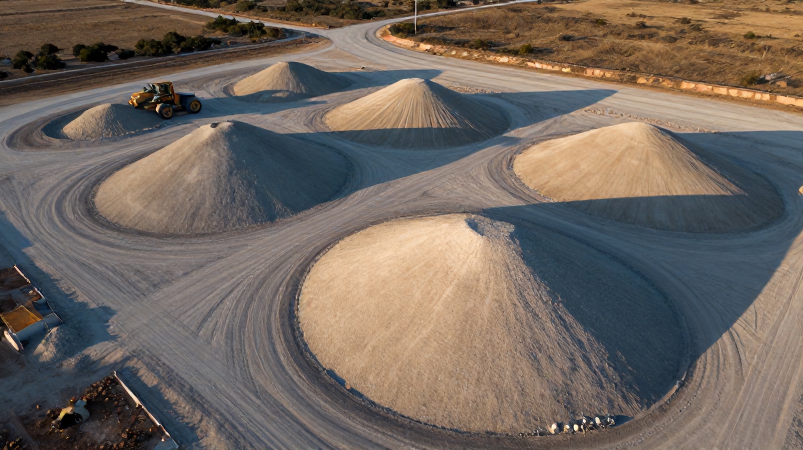
Stockpile inventory management is one of the highest-frequency applications for drone volume surveys — often performed weekly or biweekly on active quarry, mining, and materials handling sites.
Traditional stockpile measurement involves either a surveyor walking the stockpile perimeter with a total station (time-consuming, requires access at peak elevation) or visual estimation by site personnel (notoriously inaccurate — studies show human visual estimation of stockpile volume is off by 10–40% on average). Neither method provides the systematic weekly inventory accuracy that operations and financial reporting require.
Drone photogrammetry solves the stockpile inventory problem economically. A single drone flight over a materials yard with 20 stockpiles takes 20–30 minutes and delivers individual volume measurements for every stockpile — each within ±2–3% of actual. For aggregate yards, this enables: accurate raw material inventory for financial reporting, reconciliation of delivery weights against on-hand volume, and detection of material pilferage that would be invisible in delivery ticket-only accounting.
For active construction sites, weekly drone stockpile surveys track material consumption rates, flag stockpiles approaching depletion before they create supply chain disruptions, and provide accurate quantity-on-hand for cash flow projections and owner reporting. The Austin area's ongoing infrastructure boom has driven significant demand for this service from aggregate suppliers, demolition recyclers, and concrete batch plant operators.
The economic case for drone earthwork survey is compelling in any market, but Texas's project scale and survey crew costs make it particularly strong.
Traditional survey crew mobilization and field work for a 20-acre active construction site: $2,800–$5,500/month for monthly visits. Same site with drone survey: $800–$1,400/month. Annual savings: $24,000–$49,200 for a site requiring monthly volume tracking. For a 24-month large-scale earthwork project, total survey cost savings are typically $48,000–$98,400 — far exceeding the total drone program cost including processing, reporting, and analysis.
Traditional survey: 1–2 days of field work, 2–4 additional days for office processing and report preparation. Total elapsed time from field work to client receipt: 3–5 business days. Drone survey: 30–90 minutes of flight time, cloud processing begins immediately, report delivery within 24–48 hours of flight. For fast-moving earthwork phases where volume data informs next-day haul decisions, the 3-day faster turnaround has direct operational value independent of cost.
Texas Department of Transportation requires volume documentation for state highway and infrastructure projects. Traditional TxDOT-format cross-section documentation: $4,500–$9,000 per milestone submission for complex corridor projects. Drone-based documentation with equivalent cross-section outputs: $1,200–$2,800 per milestone. For highway projects with 6–10 milestone submissions over the contract duration, total documentation cost savings are $20,000–$65,000 while producing equivalent or superior measurement accuracy in the TxDOT deliverable format.
Earthwork volume disputes between GC and owner, or between GC and earthwork sub, are among the most common financial disputes in civil construction. A drone-documented volume record provides objective, timestamped evidence of quantities placed or excavated at any point in the project that cannot be disputed as selectively sampled. One avoided earthwork billing dispute — typically valued at $20,000–$200,000 on large civil projects — pays for years of drone volume survey service.
Texas's specific construction and infrastructure landscape creates particular opportunities where drone earthwork survey delivers outsized value.
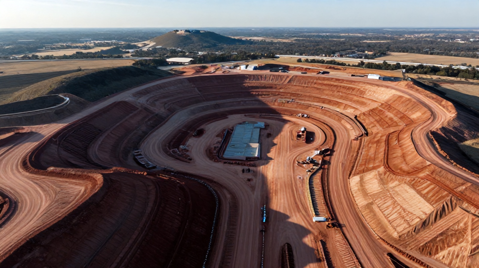
The Austin–Cedar Park–Georgetown growth corridor is one of the most active residential development markets in the US. Large-scale subdivision development — 500 to 2,000+ lot projects with extensive mass grading operations — involves millions of cubic yards of earth movement over 24–48 month development timelines. Monthly drone volume surveys replace the extensive manual staking and survey programs traditionally used to track grading progress and certify earthwork subcontractor payment milestones.
Texas highway and county road construction involves extensive cut/fill earthwork across long corridors — SH 130, US 183A, SH 45, and Loop 360 area projects are representative examples. TxDOT's standard earthwork pay quantities are based on cross-section measurements from survey data. Drone-based cross-section generation at TxDOT-required intervals produces equivalent documentation at significantly lower cost per survey event, with a continuous data record that protects the contractor against after-the-fact volume disputes.
LCRA, BCRUA, and municipal water and wastewater projects in the Austin metro involve significant trench and embankment earthwork. Drone volume surveys document compaction and backfill progress for inspector certifications, track material consumption rates for bid reconciliation, and provide as-built embankment geometry documentation for dam, levee, and impoundment structures where geometric accuracy has direct structural safety implications.
The Samsung Taylor fab plant, Tesla Gigafactory, and similar large industrial site preparation projects involve earthwork quantities measured in millions of cubic yards. Weekly drone volume surveys on these projects replace large survey field crews that would otherwise be required for equivalent coverage frequency. The Samsung fab site's earthwork alone exceeded 3 million cubic yards — monthly survey tracking at traditional prices would cost $150,000–$300,000 over the earthwork duration vs. a fraction of that with drone survey.
Drone-derived volume calculations can be stamped by a licensed Texas Professional Engineer when the data collection and processing follows documented methodology with known accuracy. Ceezaer provides complete processing documentation — GCP coordinates, processing parameters, accuracy statistics, and independent check shot comparisons — that a reviewing PE can evaluate and certify. Many large Texas civil projects now use drone-derived volumes for PE-certified pay application documentation with the reviewing PE providing the stamp after independent accuracy review.
Standing water on earthwork surfaces creates photogrammetric reconstruction problems — water surfaces are specular (reflective) and produce poor feature point matching. The practical rule is to wait 24–48 hours after significant rainfall before flying earthwork surveys. At that point, ponded water has typically drained or infiltrated and the surface is stable for measurement. Saturated soil surface conditions (mud) do not affect photogrammetric accuracy — only standing water does. For projects with aggressive monthly billing schedules, survey windows are planned for mid-month to avoid end-of-month weather risk.
Best practice is to schedule drone earthwork surveys during early morning before equipment operations begin, during lunch breaks, or at the end of the shift. This eliminates equipment artifacts in the point cloud. If survey timing cannot avoid equipment presence, the operator flags equipment-occupied areas for post-processing exclusion, and the volume report identifies these areas as estimated rather than directly measured. For sites with 24-hour operations (common on large TxDOT projects), a separate non-operational shift survey period can be negotiated as part of the drone service agreement.
Ceezaer earthwork survey deliverables are provided in: GeoTIFF DSM and orthomosaic (compatible with Civil 3D, ArcGIS, and all major GIS platforms), LAS/LAZ classified point cloud (compatible with CloudCompare, Recap, and Bentley), PDF formatted volume report with visual heat maps, and AutoCAD DXF surface files compatible with Civil 3D for direct import into the project design model. Volume calculation data is also provided in Excel format for financial reporting and pay application preparation.
For standard recurring surveys on active projects, Ceezaer schedules flights on a set day of the week with 48-hour confirmation of weather and site conditions. New project surveys should be scheduled at least 5 business days in advance to allow for flight planning, airspace coordination, and GCP survey coordination. Rush surveys (48-hour turnaround) are available for time-sensitive situations — pay application deadlines, unexpected owner requests, TxDOT inspection milestones — at a modest premium. Contact info@ceezaer.com to discuss your project timeline.
How drone point clouds from earthwork phases feed directly into construction digital twins.
Full implementation framework for drone monitoring programs on civil construction projects.
How earthwork volume savings contribute to the overall ROI of a drone monitoring program.